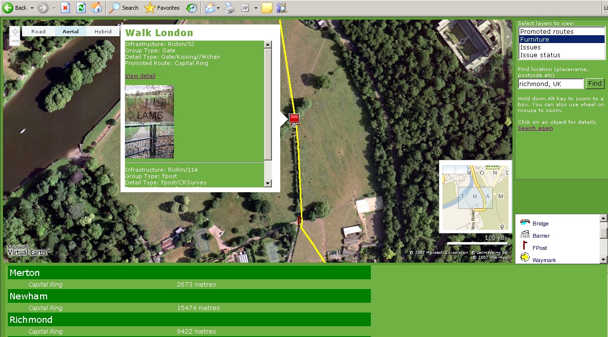
Late in 2006 we were asked if we could survey several hundreds of kilometres of walking trails across London, provide the results in a bespoke asset management system and publish the results live through a map based, web interface. A few months later our first surveyors were in the field and LAMS – the 'London Access Management System' was coming on line.
Using the Exegesis 'Path Surveyor' application, the survey team captured data on 24,000 features with 15,000 images. LAMS has a desktop component allowing trail managers to undertake detailed analysis and reporting and an advanced web viewer application based on Microsoft’s© Virtual Earth™ (VE). This project brings together the functionality and power of desktop MapInfo, the outstanding map and aerial imagery resources of the VE platform and an open source development environment to offer a very cost efficient solution.
The next step in the project is to integrate the LAMS web application into the Walk London website, allowing users highly flexible searches with information returned as maps, text and images – and even perhaps an option to use the 3D fly through capabilities of VE.
Further information is available from Kathryn Steemson.