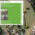
exeGesIS provided data collation, analysis and reporting services for a national project researching access to water-based recreation facilities across the UK. Water resource datasets were compiled and were subjected to network analysis to determine the accessibility of water resources.
exeGesIS were contracted by Plantlife Cymru to help with the identification of computer based methods and techniques suitable for defining and mapping Important Plant Area (IPA) boundaries. We demonstrated how spatial analysis techniques can be used to define IPA boundaries and how areas of potential IPA expansion can be modelled and visualised using GIS.
The MESH project gathered large amounts of marine habitat data from a number of European partners. These were standardised to produce a unified seabed habitat map using the best data available for each area. We produced web mapping for this project using open source Mapserver software.
exeGesIS produced a set of 20 management plans for some of Northern Ireland's top sites for the National Trust. This was done through a series of workshops with wardening staff. The final plans were handed over in CMS, giving the managers a tool to record planned activities and data collected. CMS training was also provided.
The Hampshire Biodiversity Information Centre Partnership wanted to mobilise biodiversity information and encourage greater participation in wildlife recording. An IT development plan was required before a full bid could be made to the Heritage Grants Programme. This involved liaising with contributors and the production of a costed plan.
We facilitated a management planning workshop to prepare a CMS plan for the Topla Landscape Park. Topla is a small alpine valley in northern Slovenia and has many SAC and SPA features including beech forests, capercaillie, black grouse and pygmy owls.
Devon County Council asked exeGesIS to calculate the gradients along their Rights of Way network. This would inform decisions about accessibility and the availability of the network for different users, and particularly targeting resources in order to improve accessibility.
exeGesIS used a GIS model to predict the effects of disturbance from visual stimuli on nesting stone curlew Burhinus oedicnemus. This was used to map and graph the effects of different disturbances on the birds and identify the best areas to undertake habitat management to encourage nesting.
The Pond Conservation Trust commissioned exeGesIS to develop a database for pond survey data, recruit information of relevance, create an inventory of ponds in the UK, enable online collection of pond information from members of the public and present pond information online.
exeGesIS has undertaken 25,000 km of PROW survey and have a network of trained and experienced path surveyors. One of our largest contracts was a 100% survey of the 4,500km network of paths in Cornwall.
Telephone: 01874 711145 Email: xginfo@esdm.co.uk