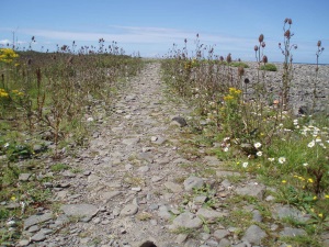
 Exegesis has produced habitat inventories for coastal vegetated shingle, saline lagoons, grassland, wood-pasture and parkland, open mosaic habitats and upland priority habitats. These have involved identifying source datasets, collating existing spatial data, capturing paper-based data, aerial photograph interpretation and processing all the available data to create standardised national datasets in MapInfo. The upland inventory also included a programme of ground truthing to establish limitations and improvement potential. These inventories provide a baseline for conserving these habitats and help to meet BAP monitoring obligations.
Further information from Claire Lush.