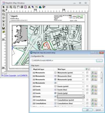
MapLink for MapInfo Professional, ESRI ArcGIS and QGIS
MapLink integrates database applications seamlessly with MapInfo Professional, ESRI ArcGIS and QGIS.
 Almost any custom-built database and all Exegesis applications can use MapLink to associate mapped features with database records. Filtered sets of records can be viewed on the map, and database records can be displayed for spatial selections made in the GIS.
MapLink also includes multi-user editing, extending standard GIS functionality to allow multiple users to edit the same spatial dataset simultaneously.
- Seamlessly integrate mapping with your application
- Store geospatial data in the application database
- Gazetteer functionality for easy map navigation
- Compatible with .NET and Office applications
- Perform intersections on spatial data and return results to database
Developer Kit
MapLink can be integrated with your own database applications with the MapLink Developer Kit.
Support and documentation
MapLink support is provided via our dedicated consultants and through the MapLink documentation website (for registered users only).