Exegesis Spatial Data Management


Posts in Category: Smartphone

Scottish Litter Monitoring System

Client: Zero Waste Scotland

Zero Waste Scotland Litter Monitoring SystemWe were contracted to provide a mobile and web-based system to monitor litter and fly-tipping for organisations in Scotland.

... read more
 

Developing CAMS Mobile

Client: Central Bedfordshire Council

Developing CAMS MobileWorking with Central Bedfordshire Council, exeGesIS developed a mobile solution for data collection in the field. This presented us with a number of technical challenges, including how to synchronise with CAMS data and how to work "offline" when there is no mobile or wifi signal. The result has been a highly robust and flexible application.

... read more
 

North York Moors Mobile Buildings at Risk Survey

Client: North York Moors National Park Authority

North York Moors Mobile Buildings at Risk SurveyWe worked with North York Moors National Park Authority to fulfil their Heritage At Risk Pilot project, developing a mobile “app” plus mechanisms for managing authentication and synchronising the survey data with the main Historic Environment Record database.
 

... read more
 

FlyMapper

Client: Zero Waste Scotland and Fly Tipping Action Wales

Flymapper fly tipping website and mobile app

FlyMapper is a tool for the reporting and management of fly tipping incidents. Developed by Exegesis, FlyMapper combines field recording of incidents via a mobile application and the management of data through a central database which is shared by multiple organisations.
 

... read more
 

Species Observations and Vegetation Recording Module

Client: GBNL (a consortium of Dutch conservation organisations)

Species observation and vegetation recording module for the Conservation Management System CMSi
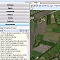
The observations and vegetation mapping module for CMSi was developed to allow managers to integrate wildlife records and vegetation surveys with their site data. This covers site monitoring projects, incidental records, data browsing and filtering, and includes a sophisticated report wizard.

... read more
 

Coast Alive Smartphone Project

Client: Norfolk County Council

Coast Alive rights of way smartphone applicationWe developed two mobile applications that demonstrated how rights of way data from Norfolk County Council and Zeeland can be consumed, shared and updated by mobile users. The applications allow the mobile user to see data and information in their local area, edit that information and report issues back to the host databases.

... read more
 
https://www.esdm.co.uk/Blog/ViewCategory.aspx?cat=128&mid=333&pageid=304