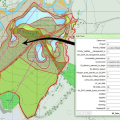
Mapping Green Infrastructure delivery Client: Natural England exeGesIS collated maps of Green Infrastructure (GI) delivery and captured the information. Areas of UK priority habitats and other GI were separately mapped and attributed. In total, 753 cases were mapped amounting to 3,485 polygons (21,342 ha). ... read more March 2013. Categories: Biodiversity Data analysis Ecology GIS Green Infrastructure Spatial data capture
Supply of Green Infrastructure monitoring Client: Natural England exeGesIS developed a methodology for monitoring Green Infrastructure (GI) delivery based upon Natural England's existing Integrated Site Assessment methodology. This encompassed ecology, access, green roofs and other aspects of GI delivery. ... read more March 2013. Categories: Biodiversity Consultation Countryside access Ecology Green Infrastructure Habitat survey Survey methodology development Workshop
Online Mapping for GiGL Client: Greenspace Information for Greater London Exegesis were contracted to create web mapping for iGiGL, the online data portal of the capital's environmental records centre. The finished mapping system reveals different data to different users. Further custom development work has allowed surveys designed by GiGL staff through the CMS to be submitted to an Indicia Warehouse. ... read more September 2012. Categories: Content Management System Green Infrastructure Greenspace Indicia Web map Web site