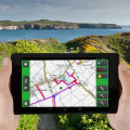
Developing CAMS Mobile Client: Central Bedfordshire Council Working with Central Bedfordshire Council, exeGesIS developed a mobile solution for data collection in the field. This presented us with a number of technical challenges, including how to synchronise with CAMS data and how to work "offline" when there is no mobile or wifi signal. The result has been a highly robust and flexible application. ... read more August 2014. Categories: App CAMS Countryside access Mobile Path survey Rights of Way Smartphone Volunteer surveys
North York Moors Mobile Buildings at Risk Survey Client: North York Moors National Park Authority We worked with North York Moors National Park Authority to fulfil their Heritage At Risk Pilot project, developing a mobile “app” plus mechanisms for managing authentication and synchronising the survey data with the main Historic Environment Record database. ... read more February 2014. Categories: App Heritage Historic Environment Record In-field technology Mobile Smartphone Volunteer surveys
Lincolnshire Heritage @ Risk Project Client: Heritage Trust of Lincolnshire This innovative project created a network of volunteer Heritage Stewards who carry out surveys of the survival and condition of Lincolnshire's heritage. These volunteers are trained to survey all types of heritage assets and feed the information into an 'at risk' database. Exegesis developed the web site for the project. ... read more December 2012. Categories: Archaeology Database HBSMR Heritage Historic Environment Record Listed Buildings Volunteer surveys Web map Web site
Wales's rights of way condition survey 2002 Client: Countryside Council for Wales The Countryside Council for Wales contracted Exegesis to design and deliver a survey to establish the condition of the path network to provide estimates of the resources required to properly maintain ... read more December 2002. Categories: Data analysis Database GIS In-field technology Path survey Rights of Way Survey methodology development Volunteer surveys