 The MESH project gathered large amounts of marine habitat data from a number of European partners. This was then standardised to produce a unified seabed habitat map using the best data available for each area.
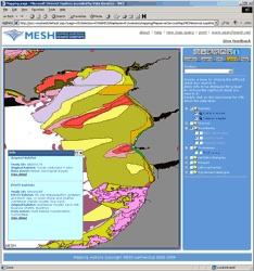
We were asked to produce the web mapping for this project using open source Mapserver software. There was also considerable consultancy on data handling and preparation.
The website and webmap was rebranded in September 2014 to form part of the EMODnet Seabed Habitats project.