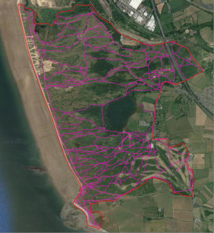
 Bridgend County Borough Council wanted a survey of various routes over the Kenfig Burrows Nature Reserve, and needed the data loading into their CAMS solution. Due to the nature of the site there was no accurate data for the location of the paths on the ground, so it was necessary to first capture the network.
Given the dynamic nature of the sand dune habitat, it was not possible to use historical mapping, MasterMap or any of the datasets that are normally used for digitising Rights of Way networks. We instead used the most recent available aerial photography to identify and capture the walked lines of the paths.
Once the network had been captured, it was loaded to the CAMS Mobile solution for the fieldwork. This allowed the surveyor to capture details of the furniture items and issues on the network, using the tablet's GPS to assist with positioning and capturing images on the tablet's camera. The data, including the digitised network, were then all synchronised back into the client's CAMS dataset, with all the photos linked to the records.
Further information from Timothy Derbyshire.