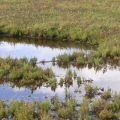
 Exegesis was contracted to establish vegetation monitoring at a saltmarsh coastal realignment site. This required the collection of high resolution aerial imagery, quadrat based vegetation survey, mapping in GIS and production of a detailed report.
...
read more