Morfa Friog is a 7.5 ha managed coastal realignment site situated on the south side of the Mawddach estuary, north of Fairbourne. Prior to the flood embankment being breached in 2015, the site was predominantly mesotrophic grassland, which was replaced by pioneer saltmarsh vegetation.
NRW contracted Exegesis to establish a vegetation monitoring programme that would allow the development of the saltmarsh to be assessed and better understood. This involved:
- Collection of high-resolution aerial photography using out fixed-wing drone.
- The generation of an accurate height model.
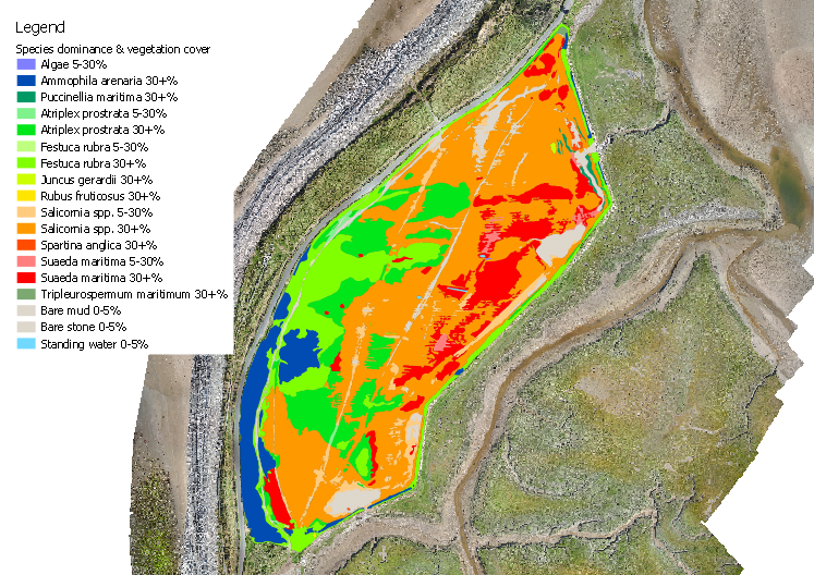
- Capture of vegetation communities based on species dominance from the aerial photography and data collected in the field. The resolution of the aerial photography made sub-metre precision mapping possible.
- The selection of three transects across the main site.
- Detailed survey of a series of randomly located 2×2 metre quadrats along the transects, located using a high precision GPS.
- Photographs of transects, quadrats and features of interest.
- A full technical report detailing the methodology and results.
The report recommended repeat monitoring surveys following the same methodology and using the same quadrat locations, so that future vegetation change could be quantified and characterised.
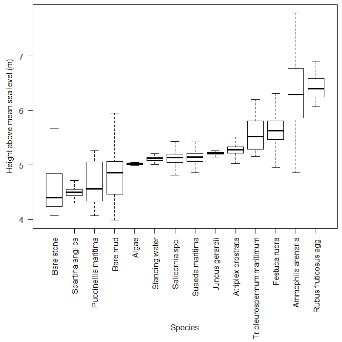 Vertical distribution of dominant saltmarsh species at the Morfa Friog coastal realignment site.
Further information from Crispin Flower.