Posts in Category: GIS

Faculty Application System and Church Heritage Record

Client: Church of England

Church of England Faculty Application System and Church Heritage RecordThe Archbishops’ Council Faculty Simplification Group commissioned a working party to make recommendations for modernising and streamlining the faculty system. As part of this endeavour, ChurchCare - the Church of England's national resource - together with Exegesis, developed the Church Heritage Record and Online Faculty System.

... read more
 

Production of a provisional inventory of Open Mosaic Habitat on Previously Developed Land in England

Client: Natural England

Open Mosaic Habitat inventory refinementExegesis were contracted to create and refine a complete provisional inventory of Open Mosaic Habitat (OMH) in England. We used a combination of available data sources and aerial photograph interpretation to accurately map possible OMH, also capturing information on the confidence that OMH was present.

... read more
 

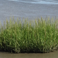
Common cord-grass Spartina anglica and its management in estuarine Natura 2000 sites

Client: Natural England

Spartina anglica in Natura 2000 sitesExegesis were contracted to undertake a review of Spartina anglica in England’s Natura 2000 Sites. This covered its impacts on designated features, effects on accretion and erosion, distribution and extent, and a review of control techniques. A protocol was developed to monitor S. anglica and help identify any negative impact.

... read more
 

Understanding the impact of invasive non-native species on protected sites

Client: Natural England

Invasive non-native species on protected sitesexeGesIS were contracted to investigate the distribution of non-native species on protected sites in England, to help develop a programme of work to tackle Invasive Non-Native Species. Large scale data analysis was used to determine which protected site each species occurred within. We also reviewed data flow within Natural England.

... read more
 

Volumetric analysis using a mini-plane DSM

Client: Natural Resources Wales

Volumetric analysis using a mini-plane DSMExegesis undertook an aerial survey of a site and orthorectified and mosaicked the imagery to create a single image. We also generate a digital surface model, which was compared against lidar data to give the change in height. We then determined the volume of additional material within patches identified from the aerial photography.

... read more
 

Norfolk Heritage Explorer

Client: Norfolk Historic Environment Service

Norfolk Heritage ExplorerWorking closely together with Norfolk Landscape Archaeology we developed the Norfolk Heritage Explorer, a sophisticated website making Norfolk's rich Historic Environment Record data accessible to the public. The website has recently been given a facelift, becoming the first of our heritage websites to use the mojoPortal CMS.

... read more
 
Find out more